Willkommen bei PSU


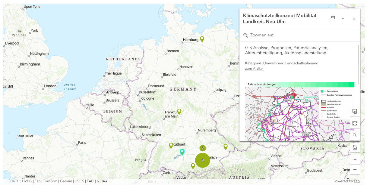
Die interaktive Karte ermöglicht das Auswählen einzelner Marker, wodurch Sie sich einen Einblick in das jeweilige Projekt verschaffen können.
Sie können die Karte im Menü über Wirkungsfelder > Überblick Wirkungsfelder und Projektkarte finden!

Vom Bund Deutscher Landschaftsarchitekt:innen ist eine digitale Broschüre zum Thema BIM in der Objekt- und Landschaftsplanung erschienen.
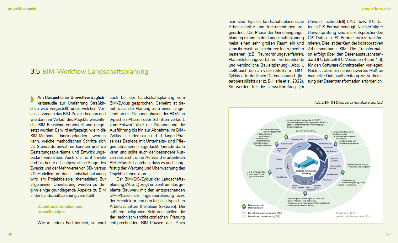
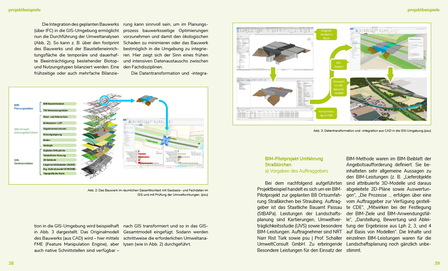
PSU stellt anhand einer Umweltverträglichkeitsstudie zur Umfahrung Strasskirchen Möglichkeiten für die BIM-Workflow-Integration in der Landschaftsplanung dar.
"Es wird aufgezeigt, wie in die BIM-Methode hineingefunden werden kann, welche methodischen Schritte sich als Standards bewähren könnten und wo Gestaltungsspielräume und Entwicklungsbedarf verbleiben. Auch die nicht triviale und bis heute oft aufgeworfene Frage des Zwecks und der Mehrwerte von 3D- versus 2D-Modellen in der Landschaftsplanung wird am Projektbeispiel thematisiert" (Dr. Johannes Gnädinger).
Die Mitteilung des bdla finden Sie unter bdla/aktuell/presse.
Zudem steht die Bröschure kostenlos zum Download [8MB] zur Verfügung.


Die interaktive Karte ermöglicht das Auswählen einzelner Marker, wodurch Sie sich einen Einblick in das jeweilige Projekt verschaffen können.
Sie können die Karte im Menü über Wirkungsfelder > Überblick Wirkungsfelder und Projektkarte finden!
Vom Bund Deutscher Landschaftsarchitekt:innen ist eine digitale Broschüre zum Thema BIM in der Objekt- und Landschaftsplanung erschienen.
PSU stellt anhand einer Umweltverträglichkeitsstudie zur Umfahrung Strasskirchen Möglichkeiten für die BIM-Workflow-Integration in der Landschaftsplanung dar.
"Es wird aufgezeigt, wie in die BIM-Methode hineingefunden werden kann, welche methodischen Schritte sich als Standards bewähren könnten und wo Gestaltungsspielräume und Entwicklungsbedarf verbleiben. Auch die nicht triviale und bis heute oft aufgeworfene Frage des Zwecks und der Mehrwerte von 3D- versus 2D-Modellen in der Landschaftsplanung wird am Projektbeispiel thematisiert" (Dr. Johannes Gnädinger).
Die Mitteilung des bdla finden Sie unter bdla/aktuell/presse.
Zudem steht die Bröschure kostenlos zum Download [8MB] zur Verfügung.